


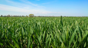
After a warm and sunny May weekend, we expect gradual cooling from Monday. Already at the beginning of the week, forecasts say that temperatures will drop in the west and the northern half of the country, and only the southern parts will remain in slightly warmer air, but with local storms. What weather to expect?
On Monday and Tuesday (April 6-7), polar air will flow from the west of Europe, and from Wednesday, arctic air will flow from the north of the continent. There will be clear weather on Wednesday and Thursday, and ground frosts will be possible at night in the northern parts. So we have a forecast repeat of April, when summer weather alternated with winter weather.
Monday May 6, 2024
On Monday, we expect heavy cloudiness with more showers in the south and southeast. Showers and thunderstorms are forecast in places, with rainfall up to 30 mm and possible hail. In the remaining area, cloudiness will be variable and light rain is possible. Maximum temperature from 16°C in the north to 24°C in the south of the country, only at the seaside around 12°C. Light and moderate wind, gusty at times, gusts up to 70 km/h during storms, west and south-west.
Tuesday May 7, 2024
On Tuesday, it will be sunny in the north, west and center of the country, with slightly more clouds in the remaining areas. Light rainfall is possible locally throughout the country, only in the southern parts of the country rainfall will be slightly stronger – up to 15 mm. The maximum daytime temperature is forecast to be from 9-10°C at the seaside, around 14-16°C in most of the country, up to 20°C in some places in the south. We expect the wind to be weak and moderate, quite strong at the seaside and in the mountains, from the north and north-east. Wind gusts over the sea may reach up to 60 km/h.
Wednesday May 8, 2024
On Wednesday, Poland is expected to enter the range of the high pressure wedge from Scandinavia, and Arctic air will flow from northern Europe. In the morning the temperature is expected to range from 1°C in the north of the country, about 5°C in the center and by the sea, to 8°C in the south-west. In the north-east of the country, ground temperature is forecast to drop to -1°C. During the day, moderately cloudy, with no precipitation. The maximum temperature is forecast to range from 15°C to 18°C in most areas, only in the north of the country and in the foothill regions from 10°C to 14°C, and on the Hel Peninsula around 8°C. The wind is expected to be weak, moderate at times, gusty in the south, north-eastern.
Thursday May 9, 2024
Thursday is expected to be sunny and rainless, but cold. At night, temperatures from 3°C to 7°C are expected, only in Kashubia around 1°C. Daytime temperatures are forecast to range from 16°C to 21°C, and in the north of the country and in the foothill regions of the Carpathians from 11°C to 15°C. The wind is expected to be weak, moderate at times, west and south-west in the north of the country, north-east in the remaining areas.
Friday May 10, 2024
On Friday, cloudy weather and occasional showers are expected. The temperature at the warmest moment of the day is expected to range from 9°C at the seaside, about 16°C in the center and the foothill regions of the Carpathians, to 21°C in the south. The wind is forecast to be weak, sometimes moderate, gusty, north-westerly and westerly.
Saturday and Sunday, May 11-12, 2024
Saturday and Sunday are forecast to be moderately cloudy, with heavy periods and light rain showers. The daytime temperature is expected to range from 9-11°C in the north and north-east of the country, around 15-16°C in the center, to 18-20°C in the west and south-west. The wind is expected to be weak and moderate, sometimes gusty in the north, from the west.
– .


